The Habitat and Biodiversity Modeler is a fully integrated support system within TerrSet software for habitat assessment, landscape pattern analysis and biodiversity modeling. There are tools for species distribution modeling and reserve planning. There is also a facility to import IUCN species range data and model biodiversity. With the Habitat and Biodiversity Modeler, you can combine the future scenario analysis from Land Change Modeler and the Climate Change Adaptation Modeler to model and visualize potential impacts due to landscape or climate change.
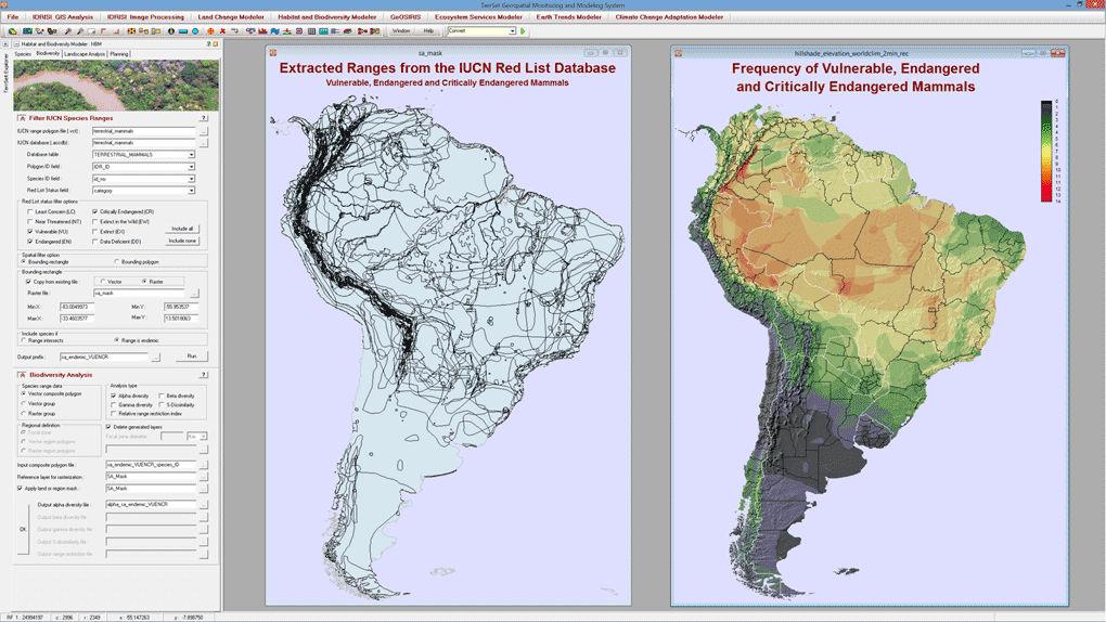
The Habitat and Biodiversity Modeler (HBM) includes a wide range of tools for habitat assessment and species distribution/biodiversity modeling. In this illustration, the IUCN Red List species database for terrestrial mammals (freely available on line) was scanned to extract the range polygons of species endemic to South America. Once extracted, the polygons were then used to create a map of frequency using the alpha diversity mapping option.
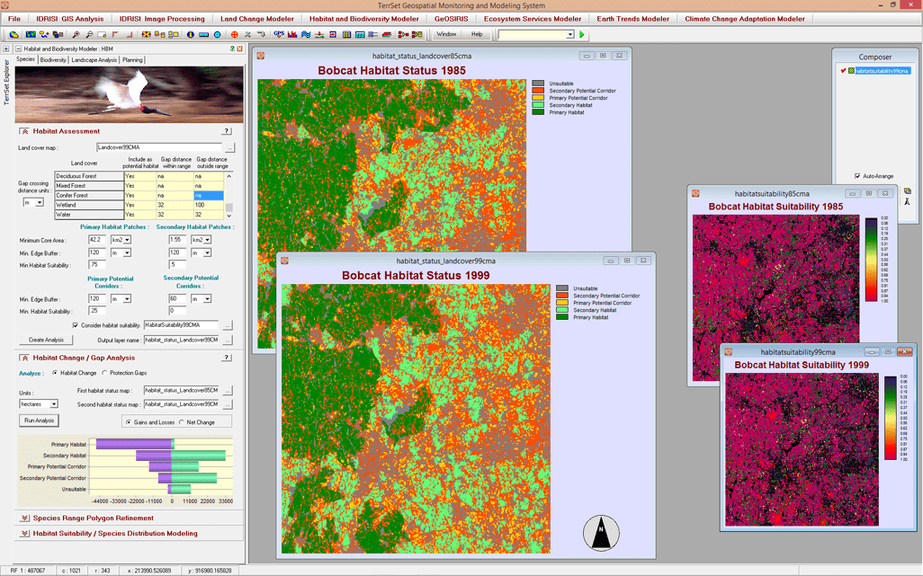
The Habitat and Biodiversity Modeler provides tools for habitat assessment. Areas are mapped into areas of primary and secondary habitat, primary and secondary corridor, and unsuitable lands based on land cover and habitat suitability. Parameters such as home range, size, buffer widths, and gap crossing distances are also used.
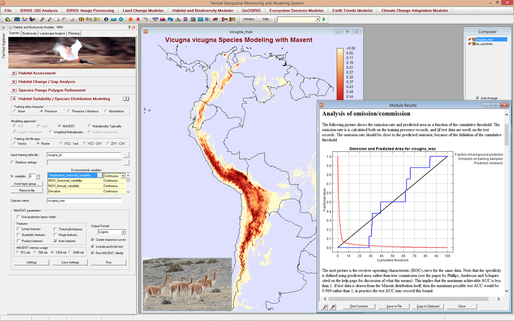
An example of the Maxent interface in HBM and its output. In this example, the range of Dromiciops gliroides (Monito del Monte) is modeled based on a collection of observation points (shown as points) and a set of nine environmental variables, such as annual mean temperature and precipitation. This new Maxent option extends the existing group of species distribution modeling tools such as the Multi-Layer Perceptron neural network, Mahalanobis Typicalities and Logistic Regression.
Customized software development, training, analytical services, and application research
Habitat and Biodiversity Modeler Key Features
Species Distribution Modeling
- Model species distributions or habitat suitability using a variety of empirical modeling approaches. An interface to Maxent is available.
- Use environmental variable maps to empirically refine species range polygon maps.
Impact Analysis
- Assess the effect of land cover change on habitat including habitat assessment, habitat change analysis, and species gap analysis.
- Derive landscape metrics including pattern analyses from a single land cover map or change process analysis from multiple land cover maps.
Biodiversity Analysis
- Calculate biodiversity through mapping of alpha diversity, gamma diversity, beta diversity, Sorensen’s dissimilarity, and range restriction.
- Import species range maps from the IUCN Red List of Threatened Species database.
Land Planning
- Generate biological corridor designs that are optimized for habitat suitability, ecological significance and protection status.
- Develop reserve selection and design scenarios using an interface to MARXAN, a conservation planning tool.